
SJRWMD Internship baseflow project, report
- Category: Maps & Data Viz
- Place: St. John's River Water Management District, Palatka FL
- Date: May-October 2022
Portfolio submission description
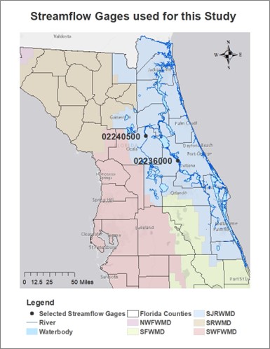
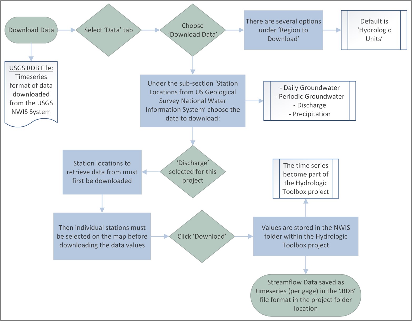
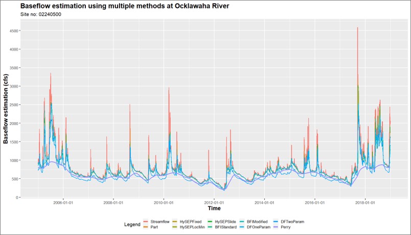
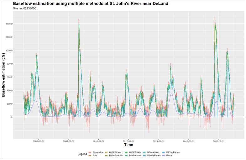
Evaluation of the groundwater contribution to streamflow, or baseflow, can improve understanding of groundwater-surface water interactions and watershed processes within a given region. Baseflow is difficult to measure directly, therefore many different statistical techniques have been developed to estimate baseflow from streamflow records. These methods primarily include hydrograph separation techniques or stage-discharge relationship curves, however, often produce a wide range of estimates that increase uncertainty in the estimated baseflow value. The St. Johns River Water Management District (SJRWMD) utilizes estimates of baseflow during calibration of groundwater models to better simulate surface and groundwater interactions within the model and evaluate impacts to groundwater from pumping. The simulation of baseflow is important for many model applications, including assessment of impacts to Minimum Flow Levels (MFLs), consumptive use permits (CUPs), and other aspects of water resource planning and management. SJRWMD uses the baseflow separation methods provided in the U.S. Geological Survey (USGS) Hydrologic Toolbox v1.0 (previously known as the USGS Groundwater Toolbox) as well as supplemental methods to estimate baseflow for groundwater modeling (Barlow et al., 2015, 2022). Present results of baseflow estimation from selected streamflow gages. Results from the baseflow separation analysis will be used to discuss variability in baseflow estimates across methods and statistical analyses to evaluate and utilize baseflow separation results for modeling.